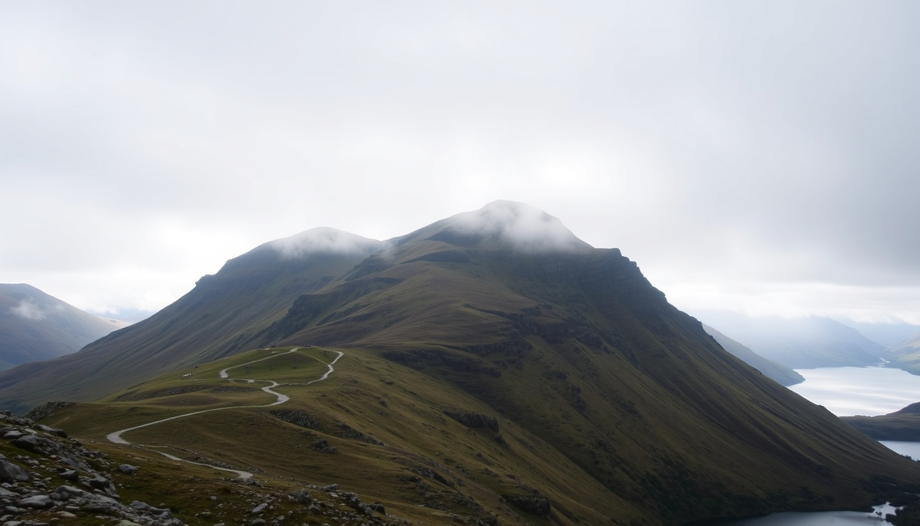
At 893 metres, Cadair Idris is one of the most prominent peaks in southern Snowdonia, yet its reputation is not built on height alone. Walkers come for the dramatic Pony Path, the glacial lake of Llyn Cau, and a summit that carries the weight of ancient legend. Whether you are planning a family day out or a challenging hill walk, understanding the routes, weather, and history of this mountain is essential.
Located within the Cadair Idris National Nature Reserve and managed by Natural Resources Wales, this peak offers some of the most rewarding hiking in Eryri (Snowdonia National Park). Its proximity to the town of Dolgellau makes it accessible, but its terrain demands respect.
How high is Cadair Idris and where is it located?
893 m (2,930 ft)
Southern Eryri (Snowdonia), Gwynedd, Wales
Pony Path (Minffordd path also moderate)
3–5 hours (round trip)
- Cadair Idris is one of the highest mountains in southern Snowdonia.
- The Pony Path is widely considered the easiest and most family-friendly route.
- Weather can change rapidly; checking the Met Office forecast is essential.
- The mountain has deep mythological ties to the giant Idris Gawr.
- Accommodation options are concentrated around Dolgellau and Machynlleth.
| Attribute | Detail |
|---|---|
| Height | 893 m (2,930 ft) |
| Prominence | 608 m |
| Grid Reference | SH 711 130 |
| Country | Wales (Gwynedd) |
| First Known Ascent | Unknown (ancient) |
| Designation | National Nature Reserve, part of Snowdonia National Park |
| Nearest Village | Dolgellau |
| Summit Name | Penygadair |
| Park | Snowdonia National Park (Eryri) |
| Nature Reserve | Cadair Idris National Nature Reserve |
What is the easiest route up Cadair Idris (the Pony Path)?
The Pony Path, known in Welsh as Llwybr Pilin Pwn, is the most recommended route for those seeking a manageable ascent. It begins in the north from Dolgellau or the Mawddach estuary, often accessed via the Ty Nant car park. At about 16 kilometres round trip, it is the longest of the main trails, but its gradient is the gentlest, making it the best choice for families and beginners.
Despite its easier profile, the Pony Path still involves a scramble to the summit. Walkers should be prepared for rocky sections and a total climb of approximately 727 metres from the mountain base. The path is well-defined in good weather but can become vague in low visibility, so carrying a map is advisable.
How difficult is the walk up Cadair Idris?
All three main routes are designated as hard or strenuous by official guides, and they require good fitness and hillwalking experience. The Minffordd Path, at roughly 11 kilometres, is the shortest but steepest option. Some experienced hikers consider it more challenging than any route up Snowdon due to its arduous terrain and steep ascents. The Minffordd Path also includes vague sections that demand navigation skills when mist or fog rolls in.
Where can I find a map of Cadair Idris?
The Ordnance Survey map (OL23) covers the Cadair Idris area in detail. For a digital alternative, Natural Resources Wales provides a downloadable map of the National Nature Reserve on its official website. Walkers are strongly advised to bring a physical map and compass, as mobile phone coverage can be unreliable.
The Pony Path is the easiest in terms of gradient, but the Minffordd Path, although harder, offers the most dramatic scenery including views of Llyn Cau. The Llanfihangel y Pennant route is moderate over its length but is the longest option for a full traverse.
Is Cadair Idris dangerous and what should I know about the weather?
The mountain is not inherently dangerous for prepared walkers, but conditions can change rapidly. The summit can be 20 degrees Celsius colder than Dolgellau, and sudden fog is common. Navigation skills are essential because paths can become vague, particularly on the Minffordd Path. Scree, boulders, and stone steps are standard across all routes, and the final approach to the summit requires a scramble.
The best time to climb is between late spring and early autumn, from May to September, when clear skies are more likely. Even then, summer weekends can be busy, and walkers should always check the Mountain Weather Information Service (MWIS) forecast for Snowdonia before setting out.
Are there any bothies on Cadair Idris?
There is no official bothy on Cadair Idris. Some sources mention informal shelters, but their condition and availability are unreliable. The nearest reliable accommodation for emergency shelter is in the valley. Day-to-day bothy availability should be checked live, as local reports can change.
The summit scramble is not suitable for complete beginners. Walkers should have experience with rocky terrain and be comfortable using their hands for balance. Wild camping is possible but check local regulations; Cwmrhwyddfor and Doleinion are legal campgrounds nearby.
What accommodation is near Cadair Idris?
Dolgellau, located about 10 miles north of the mountain, is the main hub for visitors. The town offers a range of hotels, B&Bs, and self-catering cottages. For those who prefer to stay closer to the trailhead, the Minffordd Hotel is a historic pub at the start of the Minffordd Path and offers accommodation and food. Tŷ Te Cadair Tea Room is also near the path and serves refreshments.
Camping options include Cwmrhwyddfor Campground, which is right at the base of the hike, and Doleinion Campsite nearby. Car parking is available at Dôl Idris (Minffordd) with postcode LL37 9AJ for the Minffordd and Pony Paths, and at Ty Nant for the Pony Path. Those planning a traverse from Cad West should check parking availability in advance.
During peak seasons, accommodation in Dolgellau and Glan-yr-afon fills up quickly. Book in advance and consider staying in Machynlleth as an alternative base for the southern approaches.
What is the legend of Idris Gawr and Cadair Idris history?
The mountain’s name translates from Welsh as “Chair of Idris,” referring to the giant Idris Gawr. According to local folklore, Idris sat on the summit to study the stars, and the mountain itself was his throne. The legend says that anyone who spends a night on the summit will wake up either a madman or a poet, a warning that has persisted for centuries.
The dark, circular lake below the summit, Llyn Cau, is central to the myth. It is sometimes described as the giant’s eye or a portal to the underworld. The exact origins of the name “Chair of Idris” are debated among historians, and the variation in the legend’s outcome—poet versus madman—reflects the oral tradition of Welsh folklore.
Timeline of Cadair Idris history
- Ancient – Associated with the giant Idris Gawr; legend states those who spend a night on the summit become a poet or madman.
- 1957 – Designated as a National Nature Reserve.
- 2025 – Recent updates to path maintenance and access information by Natural Resources Wales.
What is known and what remains unclear about Cadair Idris?
| Established information | Information that remains unclear |
|---|---|
| Cadair Idris is 893 m high. | Exact origins of the name “Chair of Idris” are debated. |
| The Pony Path is the most recommended easy route. | Legend outcome (poet vs madman) varies in local folklore. |
| It is within Snowdonia National Park. | Day-to-day bothy availability must be checked live. |
| Llyn Cau is the glacial lake on the mountain. | |
| Accommodation is available in Dolgellau. |
What is the background and meaning of Cadair Idris?
Cadair Idris occupies a unique position as both a recreational destination and a protected natural reserve. Its southern location within Snowdonia makes it accessible for walkers who may not wish to tackle the higher peaks further north. The comparative ease of the Pony Path relative to Snowdon has made it a gateway mountain for many hikers.
Its dual role as a nature reserve and recreational site means visitors should respect bye-laws and leave no trace. The Idris mythology adds a cultural layer that differentiates it from other Welsh peaks, linking landscape with storytelling in a way that enriches the experience of those who walk its slopes.
Sources and quotes on Cadair Idris
“Cadair Idris National Nature Reserve is made up of a range of mountains in the south of Eryri National Park.”
Natural Resources Wales
“At 893 m (2,930 ft), Cader Idris is one of the highest mountains in southern Eryri (Snowdonia).”
Visit Wales
Summary: Planning your visit to Cadair Idris
Before setting out, plan your route using the official OS or Natural Resources Wales map. Check the Mountain Weather Information Service (MWIS) forecast for Cadair Idris, and consider booking accommodation in Dolgellau or Glan-yr-afon during peak seasons. For a full experience, combine the walk with a visit to Llyn Cau lake. If you enjoyed this guide, you may also find the Malvern Hills – Complete Guide to Walking, Maps, and More useful for your next adventure.
Frequently asked questions about Cadair Idris
How long does it take to climb Cadair Idris?
Most walkers take between 3 and 5 hours to complete a round trip via the Pony Path, depending on fitness and conditions.
Is Cadair Idris harder than Snowdon?
No. Cadair Idris is often considered less challenging than Snowdon, though still a serious mountain requiring proper footwear and preparation.
What does Cadair Idris mean in English?
It translates from Welsh as “Chair of Idris”, referring to the legendary giant Idris Gawr.
Why is Cadair Idris called Cadair Idris?
The name comes from Welsh folklore: the mountain was said to be the giant Idris’s chair, from which he studied the stars.
Is there a lake on Cadair Idris?
Yes, Llyn Cau is a dark, circular glacial lake located below the summit, central to the Idris Gawr legend.
Can you wild camp on Cadair Idris?
Wild camping is possible but check local regulations. Legal campgrounds nearby include Cwmrhwyddfor and Doleinion.
Where do you park for Cadair Idris?
Dôl Idris car park (LL37 9AJ) serves the Minffordd and Pony Paths. Ty Nant car park is used for the Pony Path, and Cad West for the traverse.
Is Cadair Idris suitable for families?
The Pony Path is the most family-friendly route, but all paths require reasonable fitness and hillwalking experience. The summit scramble may not suit very young children.

Oliver Arthur Morgan Harrison is a staff writer for StoryShift.uk, covering UK news, culture, politics and technology. He works under Editor-in-Chief Maarika Tamm and UK Managing Editor Oliver Grant, following the newsroom standards for sourcing, verification and fact-checking set out in our editorial policies.